07 juin 2016
Inondations à Paris la Seine 2016. Flooding of the River Seine Paris 2016.
© Alfred YAGHOBZADEH / Divergence
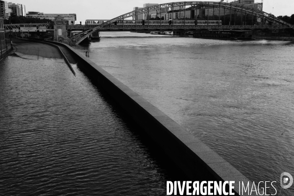
Quai de la Rapée, Pont d'Austerlitz bridge linking the Pont Charles-de-Gaulle bridge and the Quai flooded, on the left bank of the river the ©le de la Cité. The Seine River overflowed its banks, Paris City Hall closed roads along the shore of the Seine from the and on the road closed floods in Paris, Both the Louvre and Orsay museums were closed the Seine had been at its highest level in nearly 35 years. The banks of River Seine (Quais de la Seine) in Paris have been listed by Unesco as a World Heritage Site since 1991. Along the Seine are found some of Paris' most famous monuments and landmarks. Paris. France. 07/06/2016
Lieu : PARIS, FRANCE
Mots clés : Quai, ombre, Photography, shadow, intemperie, pont, alerte meteo, line, paris berges, banc, arbres, Quai de Rapee, le riviere, Urban flood, overflow, Extreme flood, damage, building, structures, bridge, roadway, eau, Fleuve, landmark, Quais de la Seine, Expressway, shore, road, closed, Water, Unesco, World Heritage, the river, Site, since 1991, River bank, submerge, drown, rain, rain swollen, wet weather, weather, famous monument, overflowed, Paris, Seine River, circulation, Route, Quai de la Rapee, Alfred Yaghobzadeh, pluie, alerte orange, Rapee, signe, debordement, pluie diluvienne, maree haute, inondation, flowing water, La Seine, crue, flood, France